Wednesday, July 28, 2010

Mt. Adams: She Said

In 2007, Ryan and I attempted to climb Mt. Adams.  It is the second largest (volumetrically speaking) and third tallest Cascade volcano, but Adams doesn’t involve anything more technical than crampons and an ice axe, so it sounded like it would be a great intro to mountaineering (pour moi).  Back then, I was in much better shape, and Ryan was still smoking, so I charged past him on the steeps to the false summit, feeling better than ever.  When we reached the false summit, the wind was howling at close to 70 mph, and I could barely crawl, much less stand and keep moving.  For this reason, we called it a day and headed back down.  The descent did not go so well.  The strength I felt at high elevation quickly dissolved as we headed down the mountain.  My quads and lungs felt great, but our rapid descent was taking its toll on my head and knees.  The issues most climbers get at altitude hit me hard once we were below 9,000 feet.  The headaches, nausea, chills, hot flashes, and disorientation left me pretty much useless.  Ryan got me to Hood River (the only part of which I remember is Ryan pulling over so I could expel the energy bar/gel cocktail from my stomach) and a bowl of broccoli and cheddar soup later, I was somewhat more lucid and functional.  So, after that miserable experience, why on earth would I ever want to go up Mt. Adams again?


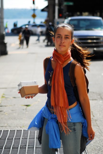
I found myself asking this question as I was drinking cold instant coffee at 5 am, at the Cold Springs camp, ready to start out on another summit attempt for Mt. Adams.  Certainly not in the shape I was 3 years ago, I still don’t enjoy energy bars, gel, and we all know how much I dislike drinking water.  This could be a recipe for disaster.  I wouldn’t let Ryan tell me what time it was, because as far as I am concerned, all that matters is that the sun isn’t up, and therefore I shouldn’t be either.  Anyhow, we gathered our gear and set off.  

The hike up to the lunch ledge was pretty uneventful.  We hit snow much earlier than last time, as in thousands of feet earlier.  The weather was absolutely gorgeous!  It was actually downright hot, with alternating hot and cold breezes, from the Columbia River gorge and the northern Cascades, respectively.  We were warned that the mountain was in late spring conditions, so we were prepared to get wet.  Following the lunch ledge is a soul-draining 2500 ft elevation gain at a consistent 30-35 degrees, heading up to the false summit.  


(Ryan scopes out the soul draining ascent)

(the steeps, you can actually see the glissade trails!  and those black dots, are people)

The roles were switched this time, and Ryan quickly left me behind.  I have always felt that women are naturally better at endurance and pacing (this was evident in my early cross-country days) and can withstand pain for longer periods of time.  So,  although I was hurting and tired of the big steps (using others boot tracks is fine, if you have an average stride… however…), I soldiered on.  


Ryan was waiting for me at the top.  We sat for a minute and watched the skiers and boarders head back down the mountain.  There were also a number of dogs with said skiers, running full speed back down the snowfield.  This reminded me of that episode of Planet Earth with the amazingly agile snow leopard (if you have seen it, you know what I am talking about).  Finally, we dusted off and went for the summit.  It was much less windy this time, and still pretty warm.  Although we were over 10,000 feet, the temperature was easily over 60 degrees.  Climbing the last 600 feet is like sprinting at the end of a race.  I’ve always considered it my strong point.  It’s a little tougher when you are climbing through a field of windblown ice sculptures.  However, we pushed on through my aching joints and Ryan’s pounding headache.  We finally reached the summit and found a dozen or so climbers lounging about in the sun, enjoying simultaneous views of Hood, St. Helens, and Rainier.  After taking the standard summit photos, we donned all of our waterproof clothes for the slide back down.  


If you haven’t glissaded before, it is kind of like luging.  On a popular climb like Mt. Adams, the glissade trails are well worn and deep, so think luging, or a really long waterslide.  Sometimes the glissade trails are straight, but often they snake and curve, bringing cries of joy out of even the most unsuspecting of mountaineer.  You slow down by using your ice axe and pray that you don’t rapidly come across a rock or large chunk of ice that might do damage to your seat pants, or worse…


We were able to glissade back down to our lunch spot, but because of the less steep slopes and soft snow, we were forced to hike the rest of the way.  I refer to this part of the journey as the knee destroyer.  Because glissading tends to cram snow into every article of clothing you are wearing, we were pretty wet.  Hiking multiple miles with soaking feet ensures a miserable outcome.  On the upside, with the exception of the feet and joints, I felt remarkably well!  I was so glad not to be dealing with the same ailments as our previous trip.  We made it back to the car and then to Hood River, where we mowed through some great bar food and Pricelined a hotel in Portland. 

Misson accomplished, score settled.  Mt. Adams – 1, Summer & Ryan – 1.  

Progress Map:

Monday, July 26, 2010

I Love You, William Shatner

No, not for your portrayal of Captain Kirk, or your work on The Practice and Boston Legal.  I love you for your ability to negotiate sweet hotel rooms at ridiculously low prices.  


After paying far too much for hotel rooms in Canada, we knew something had to give for the nights that camping just wasn't an option.  Don't get me wrong, I actually love sleeping in our tents.  My sleeping bag walls have multiple inches of downy-awesomeness and the thermarest-ridgerest double whammy is better than most hotel beds.  Our travel schedule results in single night camping at dozens of different campgrounds and parks.  Eventually, you just don't want to set up a tent for the millionth time, stuff a gigantic sleeping bag in a very small sack, or scrounge up quarters for a tepid shower full of mosquitos.  Additionally, many of these campgrounds charge upwards of thirty dollars!


So, we decided to exercise our right to hotel bidding.  Well, naming our price actually, and praying for a sweet room.  Priceline.com works by allowing you to select an area or region, a star level, and entering a price.  They work with numerous hotel chains and independents, so if one of these hotels is interested in your offer, they give you the room.  Sure, you don't know exactly where you will be staying that night (and yes, you get better deals if you wait until the day of to book), but that's part of the fun, especially in a new town or city!  


Our first big score was outside of Seattle.  We bid $38 a night on a 2 and a half star room, and got the Guesthouse Inn and Suites.  We had a kitchen, hot tub, they sold bottles of wine at reasonable prices at the front desk, and there was an REI less than a mile away!  It was so awesome, we added an extra night at the same price (they give you the option if you like your hotel).  Since then, we have been alternating camping and Priceline-ing.  We have gotten a 3-star (The Radisson, which, by the way had a Sleep Number bed) for $48, a 2.5 star Courtyard Marriott for $41, and following our climb up Mt. Adams are rewarding ourselves in the Marriott Fairfield Inn for 3 nights at a whopping $45 a night.


(Fairfield Inn in Portland)


To think, we were paying $80+ a night for a crappy room in the local Super 8 or Motel 6 across Montana and Canada!  This is just one of the many reasons we are loving our no-strings-attached lifestyle.  The room prices and layout are set for 2 people, and definitely require flexibility... so this wouldn't be possible if we had kids, pets, or any other issues.  By the time you add the price of camping, breakfast, showers, it really doesn't save us that much money if we can keep our hotel cost under $50 a night (and this generally includes breakfast and coffee).


In conclusion, embrace The Shatner and take control of your comfort and your wallet!  : )

The Joys of Self-Destruction

So, for those of you that have been to the Pacific Northwest for climbing, or anything in the backcountry for that matter, you know that perfect weather windows open rarely and even more rarely do they stay open for long (Carson, Nichols, and Dave, this is directed at you; BTW – Mt. Hood has been cloud free the last three days). This rings even more true on the Olympic Peninsula, where Summer and I watched the sea fog roll in, even on days that promised clear blue skies. This is also the only place in the contiguous United States that can claim a true rain forest, as the western Olympic region receives upwards of 120 inches of rain and 30 inches of mist each year. As we pondered what kind of atmospheric moisture would lead to 30 inches of mist accumulating in a year, we realized that perhaps only our friends James and Carol in the NW Highlands of Scotland could truly appreciate this. That being said, our visit coincided with a great wave of high pressure that leads to clear, blue skies.

This fortunate weather, coupled with my love of the mountains and my rapidly impending move to the flattest place in the world makes me to want to climb every topographic bump in sight. Thus, the tallest peak in the Olympic range, Mt. Olympus, was an obvious choice.

Problem #1: Despite what most mountaineers would consider to be a relatively low altitude (summit 7969 ft.), Mt. Olympus is glaciated to an extent comparable to peaks further inland that top 12,000 feet in elevation. This leads to complicated and dangerous glacier travel, which can be severely hazardous due to opening crevasses and weakening/collapsing snow bridges. In order to cross these safely, we often work in rope teams of at least two but ideally three or more, which becomes a problem when you are a solo climber.

Problem #2: The base camp for Mt. Olympus, dubbed Glacier Meadows, is 17.5 miles from the trailhead. This means that in order to set up basecamp in GM, you have to carry overnight gear plus all your climbing gear (= 50 to 60 pound pack) this not insignificant distance, which includes ~4000 ft. of elevation gain. Not easy when you are a climber of ~100 pounds in total body weight that does not have the knees, back, or feet for this load over this distance (hopefully everyone now understands why I was left as a solo climber; ps – I still love you Summer). Due to problem #2, a solo ascent was my only option, so I needed to determine route conditions.

Problem #3: Apparently, very little info can be found about this summit through the climbing community internet pages. Well, maybe this is not a problem. I could just go ask the rangers at the park offices. That is essentially their main job right? Not so fast. First, very few rangers have actually climbed to the summit of Mt. Olympus, but all are willing to offer their expertise. So, first ranger discussion, not helpful. As I was reminded during this ordeal, more than a few backcountry climbers in the national parks are unexperienced, make bad decisions, and end up needing rescues. This became abundantly clear as I was talked down to like a 5 year old while probing for simple info about route conditions, which seemed to be quite elusive. Fair enough, but surely they had climbing rangers on staff (See problem #4).

Problem #4: Sam is the only alpine ranger in the Olympic Range and was surely the best source of info in the area. I was told I could find Sam at the Hoh Rainforest Ranger station or up on the mountain via radio, and he could answer all my questions. This led to Problem 4a and 4b. Problem #4a: The day I arrived at Hoh Rainforest, Sam was on day one of his four day off stretch of the three week period. Perfect timing. Problem #4b: Sam apparently does not write route condition reports. So, the only person whose expertise I would trust has no info to report. Time for Plan B.

With a solo summit bid looking like a poor tactical decision, I opted for a different challenge. I would go car-to-basecamp-to-car in a day in a 35 mile roundtrip super hike. This would allow me to see the rainforest and the high country without the pack weight. If I limited my weight, I could run/jog much of this journey. I started out a 7am with a 15 pound pack with a full Camelbak, water filter, treats, crampons, ice axe, a jacket, and the trusty (sort of) SPOT locator so Summer could track my progress. The first 12.5 miles of the hike is mostly flat ground through the Hoh rainforest, a very unique and beautiful forest full of incredibly large old growth softwoods covered in moss and a forest floor composed mostly of ferns. Because this forest lies undisturbed by logging, many of the large trees that had fallen remain on the ground and actually start to form their own little mini-ecosystems on the high side. When you see a tree that is a couple hundred feet tall and more than 10 feet in diameter lying on it’s side, you begin to say a resounding ‘yes’ to the age old questions about trees falling in the woods and making noise. Many of these large trees formed perfect natural bridges across the creeks and rivers, and the park service had taken full advantage of this.

Large fallen tree bridge with my backpack outlined for scale.

At the 9 mile mark, I stopped in front of a ranger post, where I was ridiculed by a park volunteer who thought I had no chance of achieving my objective. She also thought that I was lying about coming in 9 miles from the trailhead that morning and accused me of camping without a permit. I exercised diplomacy and patience and simply kept moving.

Ranger guardpost at 9.1 miles that housed my accuser.

After jogging most of the flats, I arrived at the 12.5 mile mark after ~3 hours. At 12.5, the climbing begins, and it gets steep very quickly. My jogging was summarily reduced to a brisk walk. The trail switch backs up the Blue Glacier drainage, climbing ~4000 ft over 5 miles on the way to Glacier Meadows. Although the rainforest was beautiful, the thick forest canopy left no views for the taking. However, as I continued the climb, the forest began to open up. There was something sort of surreal about walking from true rainforest to active snow and glacial slopes. After more than 15 miles, the steep climbing was starting to take a toll, however the trail was becoming more interesting. Along this section, the trail is actually chopped out of a chossy loose cliff. On the downhill side, the hillside has a slope of 70-80°, is loose, and would result in about a 1000 ft slide for life. At one point, the trail crosses a 20 ft. whitewater gorge on a bridge that is ~120 ft. above the water. Finally, just before Glacier Meadows, the sketchy trail climbs out onto a loose, steep, avalanche/debris flow chute that drops into a gorge full of collapsing snow bridges, which I was told had resulted in the helicopter evacuation of a climber a few days ago. In order to get down into the chute ~100 ft below, you had to traverse across the loose scree without causing it to collapse and then grab a wire ladder that dropped down. Since this was my turnaround point, I considered skipping this task and calling it a day, but I had come so far. So, across the loose scree and down the ladder I went. Except for the traverse, the ordeal was sort of anticlimactic, but the surrounding views were amazing.

Now for the fun part; retracing 17.5 miles of sketchy slope and trail to get back to the parking lot, where surely Summer would be waiting with sugary treats. As I hit a wall in the last 7-9 miles, I continually think about a ranger’s inquiry at 9AM, which was “Do you normally do 35 mile day hikes or do you have some sort of affinity for torturing yourself?” My answer was yes.

Approaching the west end of the Olympus range near the 15 mile mark.


The sketchy loose traverse that leads to the cable ladder.

Friday, July 23, 2010

Photos from the Olympic Peninsula


(campsite in Port Angeles)


(in the rainforest, every roof is a green roof)


(some things never get old)


Thursday, July 22, 2010

Livin' on the Wedge

Our journey has carried us out onto the Olympic Penninsula. This part of the trip was Summer’s pick, mostly I think because it is the home of F orks, Port Angeles, and the forest battlegrounds of vampires and werewolves of Twilight fame. I think that was fair enough reasoning, as I was so graciously given the opportunity to see the newest movie, Eclipse, on our first night in Port Angeles (pretty exciting stuff man). Thank you Summer, for now my night hiking in this region may be a bit more anxious, and I will always keep ice axe in one hand and bear mace in the other, as if that would do any good (for those unaware, apparently vampires and werewolves are quite fast; oh and the only way to tell them apart is that vampires wear clothes and werewolves do not actually own shirts but have a large selection of jean shorts). Prior to this, my only exposure to werewolves was Michael J. Fox in Teenwolf, which I feel is instantly more classic than Twilight. Oh well, although I clearly don’t have the same respect for the Volturi (spelled correctly?) as my tiny friend/wife, this place is very special to me in possibly an even geekier way…………

Ladies and gentleman, this region is an accretionary wedge!

Some of you already knew this, but you likely represent the minority, so perhaps a little background is needed. Sorry if these last few blogs are turning into repeating science episodes of Mr. Magorium’s Wonder Emporium. So where to start?

In a number of places around the world, oceanic crust is being subducted or basically pushed under an overriding tectonic plate where it heads for the mantle and is destroyed. This is the “recycling” process of plate tectonics where in crust is made at mid-ocean ridges and destroyed at subduction zones (see diagram). At the boundary between the subducting plate and the overriding plate, material is scraped off and piled up to create a zone of convergence and uplift, which often leads to formation of a mountain belt in active accretionary settings.

The Olympic Mountains, in all their vampire rampant glory, actually resulted from processes such as these. In this region, the Juan de Fuca plate is actively being subducted beneath smaller microplates that compose eastern North America, and in doing so forms that Olympic Mountains. This process also generates the famous Cascade volcanoes, such as Mt. Saint Helens and Mount Rainier, although that is a story for another time.


What makes the accretionary wedge so interesting for geologists is that it is often a veritable smorgasbord of rocks. This is because this scraping off process results in extreme mixing of seafloor sediments, metamorphic rocks with lots of cool minerals, as well as basalt and other oceanic crust igneous rocks. We call this amalgamation a mélange, which I believe is a French word that means “lots of random shit.” A mélange could also represent an assortment of cookies found on sale at Big Lots.


Thus, the people of the Olympic region (including vampires, werewolves, and dramatically morose humans that hang out with both) are in fact ‘Livin on the Wedge.’